About
About The Project

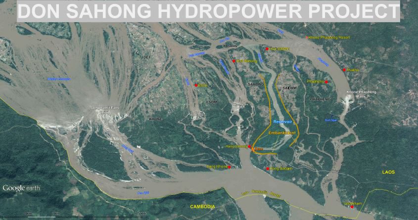
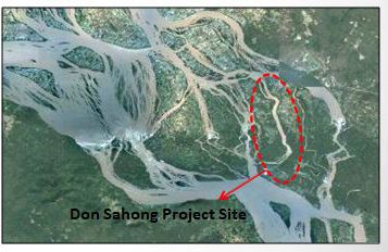
The Don Sahong Hydropower Project is a run-of-river hydroelectric power scheme located in the Khong District of Champasak Province in Southern Lao P.D.R. The scheme has been designed with a generation capacity of 260MW. The Don Sahong Dam will be located at the southern end of the Sahong channel, one of seven major channels of the Mekong River in the Siphandone (Four Thousand Islands) area that flow over the geological feature called the ???Great Fault Line???. The project would utilize 15% of the total Mekong flow. The dam and associated embankments will create a small head-pond (inundating approximately 125 hectares of land) between the islands of Don Sahong and Don Sadam. This head-pond will allow the natural fall of approximately 20m across the ???Great Fault Line??? to be utilized for power generation.
The ultimate goal is not only to build an economically viable project, but one that will provide the infrastructure, opportunity, and assistance for local development. Accordingly, a strong focus has been placed on understanding the social and environmental impacts of the project. Implementation of the social and environmental management plans, based on the process of local consultation and coordination will extend the opportunities of local people and provide the means to better their livelihoods, a key criterion for the success of the project. While producing 260MW of renewable energy for the expanding Lao national grid, the Don Sahong project would make a significant contribution to the socio-economic development of the country.
The Project Features

The Project History
In March 2006, an agreement was signed with the Government of Lao P.D.R. to conduct the Initial Feasibility Study and Environmental Impact Assessment for the Don Sahong Hydropower Project. This Initial Feasibility Study and Environmental Impact Assessment were completed in December 2007. Following this, the Project Development Agreement with the GOL was signed in 2008 allowing the preparation and delivery of the range of technical, environmental and social, financing, and contractual documents necessary to implement the project to international industry standards. Since 2007, the range of technical, social and environmental studies and documentation has been extended significantly. Several upgrades and extensions of the scope of the feasibility and social and environmental reports brought the project to a point where the reference design and environmental and social monitoring and management plans (ESMMP) could be developed.
During the course of the reference design development stage, further field data collection from the project site was undertaken, including; hydrological survey and river gauging, geotechnical investigations, topographic surveys, and fisheries studies. The hydraulic modeling was improved with the creation of a three-dimensional computational hydraulic model. The outcome of this modeling provided a much greater confidence in understanding the complex hydrology surrounding the project area. In September 2013, following updates to reflect the most current understanding of the social and environmental impacts, the documents required for the MRC Notification (as required under the 1995 Mekong Agreement), were submitted to the Lao Government and in turn to the MRC secretariat.